


Le tanet

veroberton
User
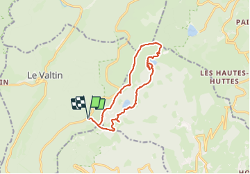

Length
12.6 km

Max alt
1300 m

Uphill gradient
597 m
Km-Effort
21 km

Min alt
1049 m

Downhill gradient
594 m
Boucle
Yes
Creation date :
2023-07-21 11:02:45.154
Updated on :
2023-07-21 15:13:34.632
4h09
Difficulty : Medium

FREE GPS app for hiking
 SityTrail
IGN / Geographical institutes
SityTrail Plus
The world is yours!
About
Trail Walking of 12.6 km to be discovered at Grand Est, Vosges, Le Valtin. This trail is proposed by veroberton.
Positioning
Country:
France
Region :
Grand Est
Department/Province :
Vosges
Municipality :
Le Valtin
Location:
Unknown
Start:(Dec)
Start:(UTM)
354432 ; 5327502 (32U) N.
Comments